
Most trekkers in Nepal have heard of Thorong La or Cho La. Almost none have heard of Phyajang La and that’s exactly what makes it special.
Sitting at 5,496 meters in the far reaches of upper Humla, Phyajang La is the highest point of the Humla Changla Valley Trek. There are no crowds here. No teahouses. No souvenir stalls at the top. Just thin air, wide views, and a real sense of standing somewhere very few people ever go. Here’s everything you need to know about it.
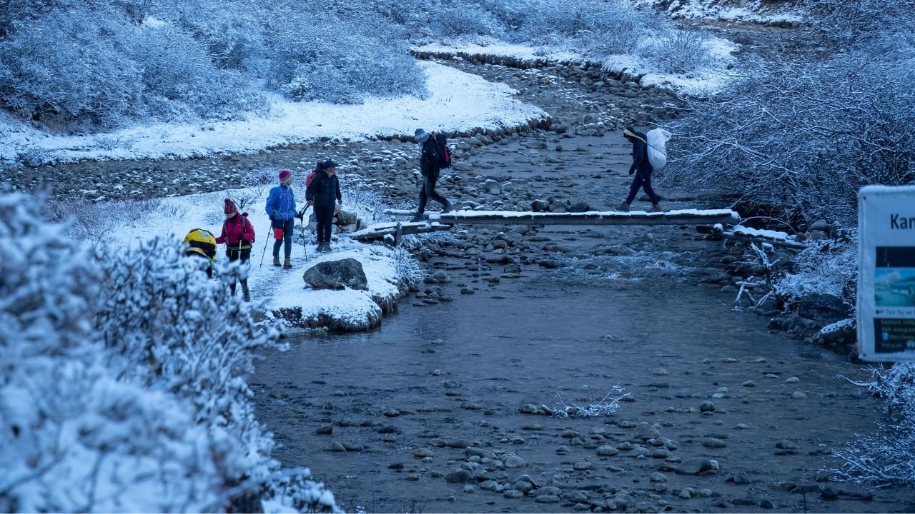
Phyajang La Pass trek: Photo by Nishant Rana
Where Is Phyajang La Pass
Phyajang La sits deep in upper Humla, close to the Tibetan border, in Nepal’s far northwest. It’s the high point of the Humla Changla Valley Trek a remote camping route that starts in Simikot and pushes into some of the least-visited terrain in the entire country.
At 5,496 meters, it’s higher than Thorong La (5,416m) on the Annapurna Circuit and higher than Cho La (5,420m) near Everest two of Nepal’s most famous passes. The difference is that almost nobody crosses Phyajang La. While thousands of trekkers cross Thorong La every season, Phyajang La sees only a handful of visitors a year.
How You Get There
Reaching Phyajang La isn’t a quick side trip it’s the reward at the end of a long, steady climb through some of Humla’s most remote valleys. Here’s the general shape of the route:
- Simikot (2,910m) — the starting point, reached by flight via Nepalgunj
- Dojam (2,540m) — the trail heads east from Simikot into Humla’s backcountry
- Sabakong (3,186m) and Dukling (3,585m) — steady climbing through forested valleys
- Gurukpa (3,985m) — higher ground, thinner air, fewer signs of settlement
- Medokding and Tashilung (4,290m) — deep into camping-only territory, no lodges from here on
- Changmatang (4,556m) — a wide, grassy meadow surrounded by rock walls and glaciers; this is base camp for the pass
- Phyajang La (5,496m) — the crossing itself, usually a long day of 8–9 hours
Each stage typically takes one trekking day, with the whole approach spread across roughly a week before the pass itself.
What the Crossing Is Actually Like
The night before, trekkers camp at Changmatang a broad meadow ringed by rock walls and glaciers, often with wild goats grazing nearby. It’s cold, quiet, and about as far from civilization as trekking in Nepal gets.
The crossing day itself is long: around 9 hours from base camp to the other side. The climb is steady rather than technical no ropes or scrambling but the altitude makes every step harder than it looks on paper. Above 5,000 meters, the air holds roughly half the oxygen you’d get at sea level, so a normal walking pace can feel like real effort.
The payoff is the view from the top. Behind you: the wide valleys of Humla you’ve spent days climbing through. Ahead: the mountain ranges of Tibet. It’s less a photo-stop and more a moment a clear sense of exactly how far from anywhere you are.
After the pass, the trail descends toward Nying Kuna, a peaceful spot surrounded by mountains, roughly 6–7 hours below the summit. Because that day comes after the hardest push, most itineraries build in an easier following day toward Chhorten Chhobu, on wide, gentle terrain with a low elevation gain a welcome breather after the pass.
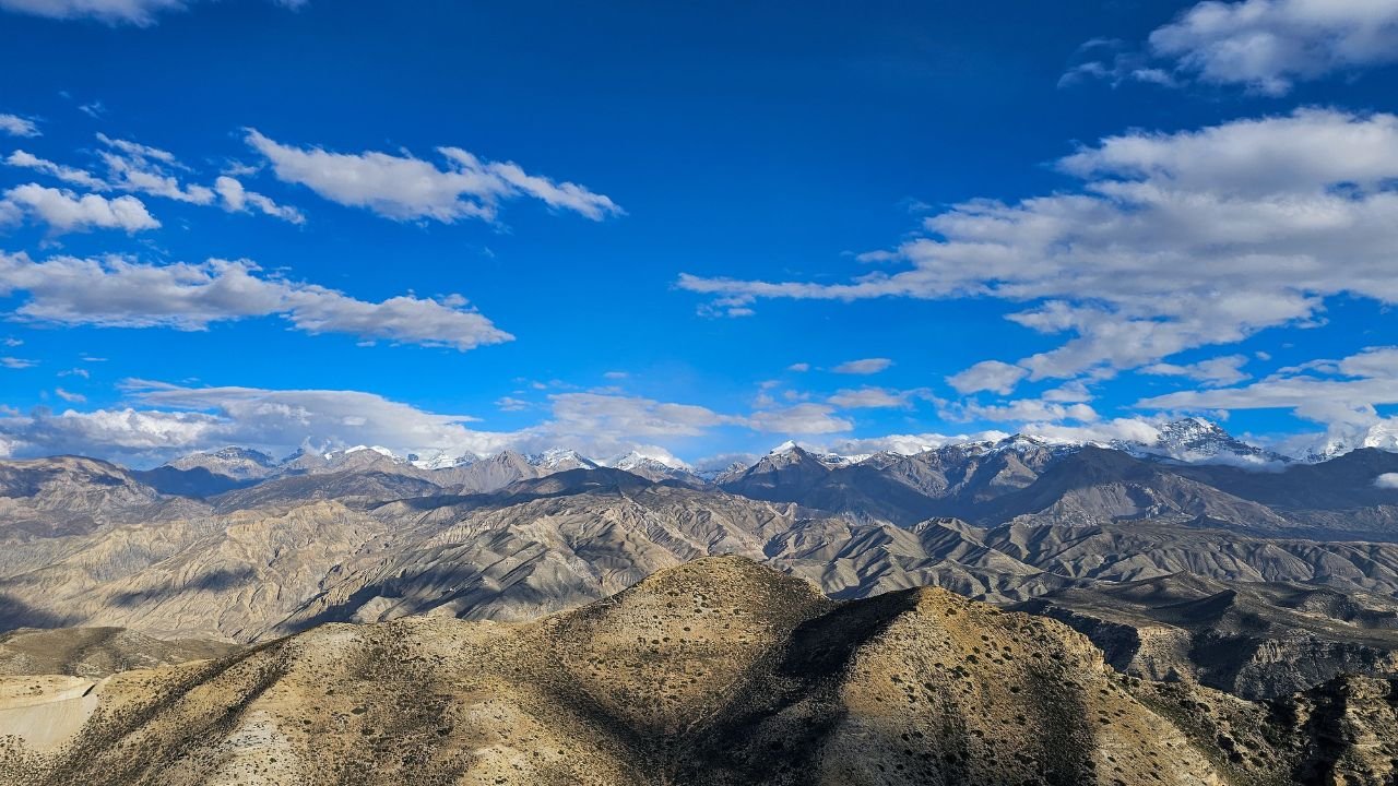
Phyajang La Pass: Photo by Sagar Gnawali
How Phyajang La Compares to Nepal’s Famous Passes
| Pass | Elevation | Region | Trekker Traffic |
|---|---|---|---|
| Phyajang La | 5,496m | Upper Humla | Very low a handful of trekkers per year |
| Cho La | 5,420m | Everest/Khumbu region | High |
| Thorong La | 5,416m | Annapurna Circuit | Very high |
| Kang La | 5,320m | Nar Phu Valley, Annapurna | Moderate |
Phyajang La is technically the highest of the four but it’s the one almost nobody has crossed. If Thorong La and Cho La are the “bucket list” passes everyone talks about, Phyajang La is the one for trekkers who’d rather have the mountain to themselves.
Is It Difficult? What to Know Before You Go
Phyajang La isn’t technically hard there’s no glacier travel or climbing involved but it’s still a serious undertaking. A few things to keep in mind:
- Altitude is the main challenge. Above 5,000m, thin air makes even a gentle slope feel steep. The gradual, multi-day approach helps your body adjust before the final push.
- It’s remote, not just high. Unlike Thorong La, where help and teahouses are nearby, Phyajang La is days from the nearest road or town. This isn’t a pass to attempt without proper support.
- You’ll need a full camping setup. There are no lodges anywhere near the pass tents, a cook crew, and often porters or mules are standard for this stretch.
- A permit is required. Upper Humla is a restricted area, so the pass can only be crossed as part of an organized trek with the correct permits arranged in advance.
Should You Add Phyajang La to Your Trip
If you’re already planning the Humla Changla Valley Trek, Phyajang La isn’t optional it’s the trek’s centerpiece. But it’s worth going in with the right expectations: this is a physically demanding, logistically serious undertaking, best suited to trekkers with prior high-altitude experience rather than a first Himalayan trip.
For trekkers who’ve done the classic passes and want something genuinely off the map, Phyajang La offers what Thorong La and Cho La can no longer promise real solitude, at real altitude, in one of the last corners of Nepal that still feels untouched.
