
Is the Annapurna Circuit still worth doing now that jeep roads run through parts of it? Short answer: yes — and the way you get the version of the trek that still feels like the legendary Annapurna Circuit is by knowing which trail to take.
Roads have crept into the Marshyangdi valley over the past two decades, and a fair number of trekkers now skip whole sections by jeep without realizing they didn’t have to. But a parallel network of foot trails, known as NATT (Natural Annapurna Trekking Trails), was built specifically to route hikers around the dusty, noisy road sections and back onto forest paths, suspension bridges, and villages that vehicles can’t reach. Walk the NATT alignment and you’re doing something very close to the original circuit just with better teahouses than it had in 2005.
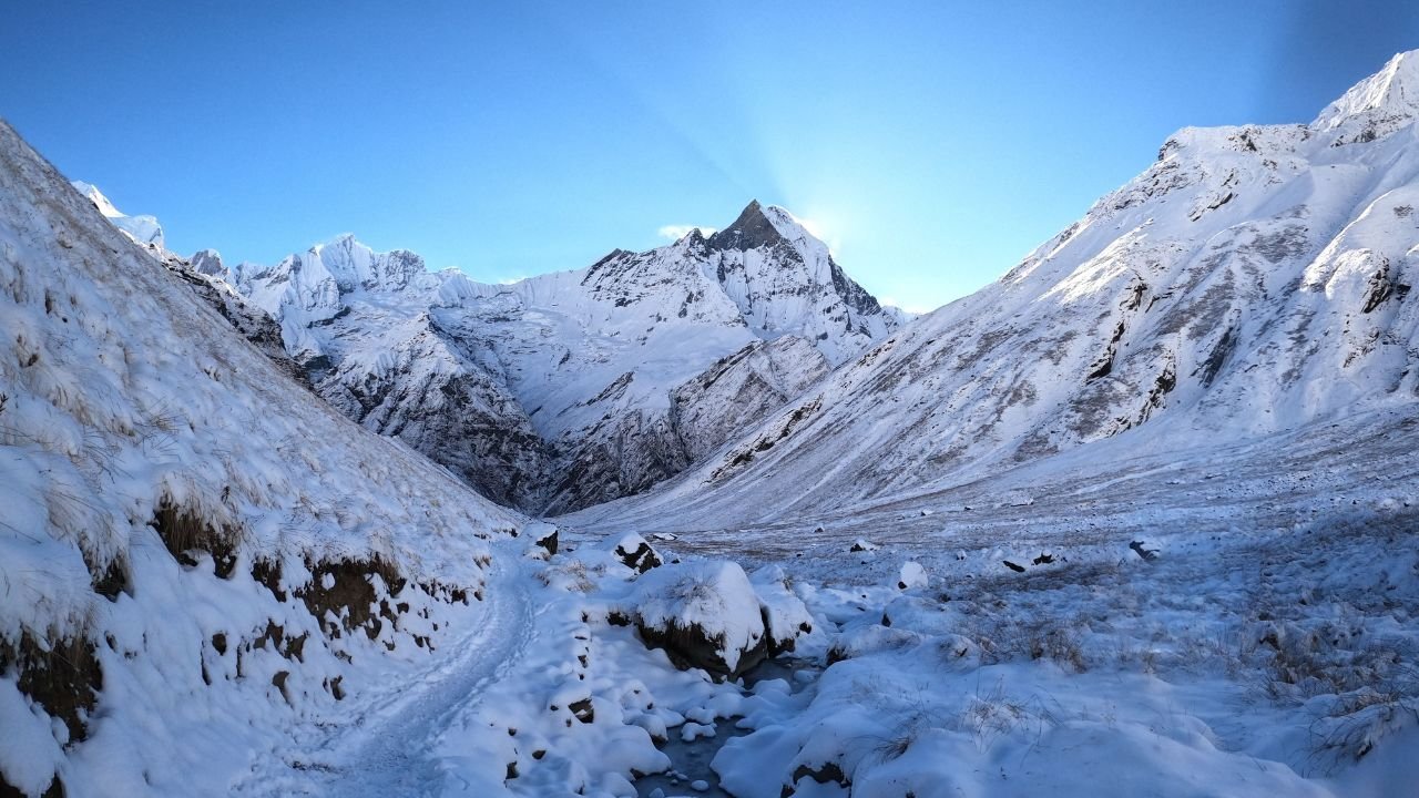
Annapurna Circuit trek: Photo by VIKRAM GUPTA
This guide covers the 2026 route as it actually exists: what’s walkable, what’s roaded, the realistic 14-15 day itinerary, permits, costs, and the acclimatization schedule that actually gets you over Thorong La safely.
What the Annapurna Circuit Actually Is
If you’ve also looked into the Annapurna Base Camp trek, it’s worth clearing up the difference early, because the names get confused constantly. ABC is a there-and-back trek into a mountain amphitheater. The Annapurna Circuit is a loop you walk around the entire Annapurna massif, crossing from one side of the range to the other over the Thorong La pass at 5,416 meters, then descending through a completely different valley on the way out. You don’t retrace your steps.
That loop structure is what makes the Circuit unusual: in a single trek you pass through six distinct ecological and cultural zones, from subtropical rice terraces and rhododendron forest at the start, through Gurung and Manangi villages in the high valleys, over a high-altitude desert pass, and down into the Mustang region’s dry, Tibetan-influenced landscape around Muktinath. Few treks anywhere pack in that much variation.
Is the Annapurna Circuit Still Worth It in 2026? (The Road Reality Check)
Here’s the honest version. Road construction, mostly for local transport and trade rather than tourism, has reached into the lower and middle sections of the route, particularly between Besisahar and Manang, and again on the descent from Muktinath toward Pokhara. Some trekkers now ride a jeep through these stretches instead of walking them, either by choice or because they don’t know an alternative exists.
The NATT trail system was developed as a direct response to this. It’s a signposted network of alternate foot paths that runs parallel to the road, ducking into forest, crossing the river on the old suspension bridges, and passing through villages the jeep track bypasses entirely. Trekking associations estimate NATT lets you avoid roughly 90% of the road on foot. The core of the trek Manang, the approach to Thorong La, Muktinath, and the upper Kali Gandaki valley was never touched by road construction in the first place and remains exactly the trek it always was.
So the pragmatic answer: the Circuit of 2005 doesn’t exist anymore, but a trek very close to it does, and NATT is how you find it. Where this guide’s itinerary uses a NATT alternative instead of the road, it’s noted.
The Classic 14-15 Day Itinerary
This is the version most trekkers actually do, and the one built around a proper acclimatization schedule rather than rushing to compress the trek into the fewest days possible. It follows NATT alignments wherever one exists, with jeep sections used only where there’s genuinely no walking alternative (the very start, and the final return leg).
| Day | Route | Distance / Time | Altitude |
|---|---|---|---|
| 1 | Kathmandu to Besisahar/Dharapani (drive) | 6-9 hrs | 1,860m |
| 2 | Dharapani to Chame | 5-6 hrs | 2,670m |
| 3 | Chame to Pisang | 5-6 hrs | 3,200m |
| 4 | Pisang to Manang (via Gyaru–Ngawal, NATT high route) | 7-8 hrs | 3,540m |
| 5 | Rest and acclimatization day in Manang | — | 3,540m |
| 6 | Manang to Yak Kharka | 4-5 hrs | 4,020m |
| 7 | Yak Kharka to Thorong Phedi or High Camp | 3 hrs | 4,450m |
| 8 | Thorong Phedi/High Camp over Thorong La to Muktinath | 7-9 hrs | 5,416m pass / 3,760m Muktinath |
| 9-10 | Muktinath to Jomsom, explore | 4-5 hrs | 2,720m |
| 11 | Jomsom to Pokhara (flight or 9-12 hr jeep) | varies | 820m |
| 12-14 | Pokhara to Kathmandu, buffer/rest days | 6-9 hrs | 1,400m |
Two things on this table worth calling out rather than glossing over.
The Manang rest day on Day 5 isn’t a scenic bonus it’s a hard acclimatization requirement built into every credible itinerary on this route. Skipping it to save a day is one of the more common mistakes trekkers make on the Circuit, and it’s the one most directly tied to altitude sickness incidents further up the trail. Many trekkers use the day to visit the Himalayan Rescue Association clinic in Manang, which runs daily altitude talks during the season.
The Pisang-to-Manang leg is written here via the high route through Gyaru and Ngawal rather than the lower road-adjacent path. It’s a longer day, but it’s also one of the best NATT alternatives on the whole trek better mountain views, quieter trail, and it adds useful acclimatization elevation gain before the harder days ahead.
If you have extra time, Tilicho Lake is the most popular add-on to this itinerary, reached via a side trip from Manang before rejoining the main route. It adds 2-3 days and a genuinely spectacular high-altitude lake, but it’s substantial enough that it deserves its own planning rather than a paragraph here.
Thorong La Pass: What the Big Day Actually Involves
Thorong La, at 5,416 meters, is the trek’s highest point and the day everything else on the itinerary is designed around. It’s not a technical climb no ropes, no scrambling but it’s a long, cold, high-altitude day, and it demands respect rather than just fitness.
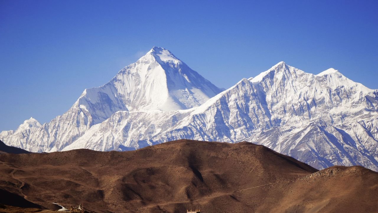
Thorong La Pass: Photo by Drift Shutterbug
The standard approach is a pre-dawn start from Thorong Phedi or High Camp, usually well before sunrise, to cross before the winds pick up in the afternoon. Expect 7-9 hours of walking total, temperatures well below freezing at the start, and a long, knee-jarring descent to Muktinath on the far side. Trekkers who’ve done their acclimatization properly generally describe it as hard but manageable; trekkers who rushed the schedule are the ones who struggle.
Altitude sickness is the real risk here, not the terrain. Early symptoms headache, unusual fatigue, nausea, trouble sleeping can resemble a mild cold, and the single most important rule is simple: don’t continue ascending if you have symptoms that aren’t improving. This is exactly why the itinerary above builds in the Manang rest day and a gradual approach through Yak Kharka and High Camp rather than pushing straight up.
Best Time to Go
Autumn (mid-October to mid-November) is the most reliable window and the busiest. Stable weather, clear mountain views, and the pass reliably open. Early October is worth avoiding if you can shift your dates the tail end of monsoon season means less settled weather and a higher chance of the kind of sudden storm systems that have historically caused serious incidents on the pass. Once you’re past mid-October, conditions firm up considerably.
Spring (April to May) is the second reliable window, with rhododendron forests in bloom lower down and generally good pass conditions, though slightly hazier mountain views than autumn.
Winter (December-February) sees Thorong La snowed in unpredictably, and while it can be crossed with the right conditions and a guide who knows the current situation, it’s not something to plan around in advance. Monsoon (June-September) brings leeches, cloud cover, and landslide risk on the lower sections, and most trekkers skip this window entirely.
Permits: What You Actually Need in 2026
The core requirement is the Annapurna Conservation Area Permit (ACAP), priced at NPR 3,000 (roughly $25-30 depending on the exchange rate) for foreign nationals. It’s a single-entry permit issued by the National Trust for Nature Conservation, and it covers every trail inside the conservation area, including the full Circuit. You’ll need it before you start walking there’s nowhere to obtain it once you’re on the trail, so arrange it in Kathmandu or Pokhara beforehand with your passport and a passport photo.
Since April 2023, Nepal has required all foreign trekkers on this route to travel with a licensed guide or through a registered trekking agency; unguided solo trekking is no longer permitted in the Annapurna region.
One honest caveat: current sources genuinely disagree on whether the TIMS card is still a separate requirement alongside ACAP. Some say it was effectively discontinued when the guide mandate came in; others still list it as a required document at around NPR 2,000. Rather than guess, confirm the current requirement directly with the Nepal Tourism Board, TAAN, or your trekking agency before you go this is exactly the kind of rule that has shifted since 2023 and could shift again.
Cost Breakdown
Realistic 2026 budgets fall into three rough tiers:
- Budget guided trek: $700-1,000 total — basic teahouses, a licensed guide, no porter, minimal extras
- Standard guided trek: $1,200-1,800 total — the range most trekkers land in, covering permits, guide, teahouse rooms, meals, and ground transport
- Full-service package: $2,000-2,500 — better accommodation, porter support, and more logistics handled for you
The permit fee itself is fixed and small relative to the total trip cost. What actually drives the variance is guide and porter fees, room quality, whether you fly or drive between Jomsom and Pokhara, and season spring and autumn trekking typically runs 15-25% more expensive than the quieter winter and monsoon months, mostly due to demand on guides and lodges.
Teahouse rooms themselves are often cheap or even free if you’re eating your meals at the same lodge, which is the standard arrangement on this route. The real cost driver day to day is food, and prices climb steadily with altitude a plate of dal bhat in Chame costs meaningfully less than the same meal in Thorong Phedi, simply because everything above the roadhead has to be carried in.
Training and Fitness Prep
You don’t need technical climbing experience for the Circuit, but you do need to arrive with real cardiovascular fitness and some experience walking multiple consecutive days with a loaded pack. Most guides recommend starting training 8-12 weeks out, with cardio sessions 4-5 times a week and, where possible, long uphill hikes of 4-6 hours to build the specific stamina the trek demands. Stair climbing with a loaded pack is a reasonable substitute if you don’t have hills nearby.
The honest bar to clear: can you walk 5-8 hours a day, several days in a row, at altitude, with tired legs and thinner air? That’s the trek. Fitness reduces how hard those days feel; it doesn’t replace proper acclimatization.
Practical Logistics
Getting to the trailhead means a drive from Kathmandu to Besisahar or on to Dharapani, either by public transport (cheaper, slower, a full day) or a private jeep (faster, more expensive, more flexible on timing).
Coming out, the Jomsom-to-Pokhara leg has a real trade-off: a 25-30 minute mountain flight with excellent Dhaulagiri and Annapurna views, but weather-dependent and prone to delays, versus a 9-12 hour jeep along the Kali Gandaki that always runs but eats most of a day. If your schedule has any flexibility, build in a buffer day around the flight rather than booking a tight connection straight through.
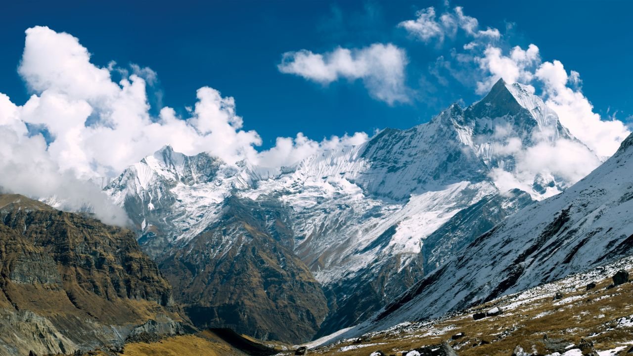
Annapurna Circuit: Photo by thepoeticimagery
Trail Highlights Worth Slowing Down For
The day-by-day table covers logistics, but a few stops on the route reward more than a passing glance.
Manang is the trek’s cultural and logistical hub, a Manangi trading town where the acclimatization day gives you time to actually look around rather than just rest. The Himalayan Rescue Association clinic here runs daily altitude talks in season, and the town’s monasteries and mani walls reflect a Tibetan Buddhist culture distinct from the Gurung villages lower down the valley.
The Gyaru-Ngawal high route between Pisang and Manang is the NATT alternative worth prioritizing over the road-adjacent lower path. It climbs higher, stays quieter, and delivers some of the best unobstructed views of Annapurna II, III, and Gangapurna on the entire trek.
Muktinath is a genuinely significant pilgrimage site for both Hindus and Buddhists, not just a stopover after the pass. The temple complex, with its 108 water spouts, draws pilgrims independently of the trekking season, and it’s worth an hour or two beyond the usual overnight-and-move-on pace.
The Kali Gandaki gorge, on the descent toward Jomsom, is considered one of the deepest gorges in the world, with Dhaulagiri and Annapurna rising on either side of the river. It’s also where the trek’s landscape shifts most dramatically, from the high desert around Muktinath into the windswept Thakali villages of lower Mustang.
Common Mistakes to Avoid
A few patterns show up repeatedly among trekkers who have a rough time on the Circuit, and almost all of them are avoidable with planning rather than fitness:
- Skipping or shortening the Manang acclimatization day. Covered above, but worth repeating as its own point — this is the single most common cause of altitude problems higher up the trail.
- Booking too tight a schedule around the Jomsom flight. Mountain flights get weather-cancelled regularly. A same-day connection to an international flight home is a genuine risk; build in at least one buffer day.
- Underestimating the cold at Thorong Phedi and High Camp. Even trekkers who packed well for the lower valleys are sometimes caught off guard by how cold pre-dawn starts near 4,450m actually feel. Layer for well below freezing.
- Assuming last year’s permit rules still apply. Guide requirements and permit structures have changed more than once since 2023. Confirm current rules close to your departure date rather than relying on an old blog post (including, to be fair, parts of this one a year from now).
- Rushing the itinerary to save a day or two. The 14-15 day version exists because it matches a safe acclimatization curve, not because operators are padding it. Compressed itineraries increase AMS risk on the days that matter most.
What to Pack
A full gear list deserves its own dedicated post, but the essentials specific to this trek’s temperature swing are worth flagging here: you’ll start in humid, subtropical warmth around 800-1,800m and finish at a windswept 5,416m pass, often within the same week.
- Layered system: moisture-wicking base layers, an insulating mid layer, and a windproof/waterproof outer shell
- A good sleeping bag rated well below freezing (many teahouses are unheated above Manang)
- Sturdy, broken-in trekking boots this is not the trip to test new footwear on
- Trekking poles, genuinely useful on the Thorong La descent
- Water purification (tablets or a filter) rather than relying on bottled water throughout
- Basic altitude medication as advised by a travel doctor, and a personal first-aid kit
- Sun protection UV exposure at altitude is far stronger than it feels
Frequently Asked Questions
How hard is the Annapurna Circuit Trek?
It’s a moderate-to-challenging trek. No technical climbing skill is required, but it demands sustained multi-day fitness and a properly paced acclimatization schedule, particularly around the Thorong La crossing.
Do I need a guide for the Annapurna Circuit in 2026?
Yes. A licensed guide or registered trekking agency has been mandatory since April 2023, and unguided solo trekking is not permitted in the Annapurna Conservation Area.
How many days does the Annapurna Circuit take?
Itineraries range from around 10 to 21 days depending on how much of the route is walked versus driven and whether side trips like Tilicho Lake are included. 14-15 days is the standard, well-acclimatized version.
Is the Annapurna Circuit ruined by the road?
No, though it has changed. Road construction has reached the lower and middle valley sections, but the core of the trek from Manang through Thorong La to Muktinath remains untouched, and the NATT trail network lets you avoid most of the roaded sections on foot elsewhere.
When is the best time to trek the Annapurna Circuit?
Mid-October to mid-November and April to May are the two reliable windows, offering the most stable weather for the Thorong La crossing.
The Circuit in 2026: Different, Not Diminished
The Annapurna Circuit of guidebooks past no roads, no wifi, nothing but trail isn’t what you’ll walk in 2026. But dismissing the trek on that basis misses what’s actually still there: a full loop around one of the world’s great mountain massifs, a genuine high-altitude pass crossing, six cultural and ecological zones in one trip, and a NATT trail network built specifically to preserve the walking experience that made this trek legendary in the first place. Plan around the acclimatization schedule, take the foot trail over the jeep track where you have the choice, and this is still one of the best long treks in Nepal.
For shorter or easier alternatives in the same region, see our guides to Nepal’s best trekking routes and beginner-friendly hiking trails. If you’re still deciding where to trek this year, our full Nepal trekking places guide covers how the Circuit compares to Everest Base Camp and other major routes, and our trekking agencies guide can help with finding a licensed guide for the mandatory permit requirement.
