
A river can rise after hours of heavy rain. In Nepal’s mountains, however, a flood can sometimes arrive from somewhere people cannot even see.
High above the valleys, glaciers are retreating, frozen ground is changing, lakes are expanding, and steep mountain slopes are becoming increasingly unstable. When ice, rock, snow and water suddenly move together, the result can be far more destructive than an ordinary river flood.
The devastating flooding along Nepal’s northern border in August 2026 has brought that risk into sharp focus. The event was linked to a large ice-and-rock collapse in the high Himalayas, which sent a powerful surge downstream and caused extensive destruction along river valleys. Scientists are still examining the precise sequence of events, but the disaster has renewed a difficult question for Nepal:
Are Himalayan floods becoming more dangerous as the mountains warm?
The answer is increasingly concerning but it is not as simple as saying that every flood is caused by climate change.
The danger comes from a combination of changing climate conditions, unstable terrain, expanding glacial lakes, extreme rainfall, rapidly changing rivers and development in narrow mountain valleys.
Nepal’s mountains are not standing still
The Himalayas may look permanent from a distance. Geologically and climatically, they are anything but.
Glaciers are constantly moving. Snow accumulates and melts. Rivers cut through rock. Landslides reshape slopes. Lakes appear and disappear. In frozen mountain soils, ice can act like a natural glue holding rocks and sediment together.
As temperatures rise, these processes are changing.
Glaciers in the Hindu Kush Himalaya are losing ice, while many high-altitude areas are experiencing changes in snow cover and frozen ground. These changes do not simply mean that there is “less ice.”
They can also alter the stability of the entire mountain environment.
That distinction is important.
A warming mountain landscape can create new lakes, enlarge existing ones, weaken ice and rock structures, and change the way water moves through valleys. The result is a landscape in which several hazards can interact.
Scientists sometimes refer to these as compound hazards—when one event triggers another.
A landslide can fall into a glacial lake.
The impact can generate a wave.
The lake can then burst.
The resulting water can pick up boulders, trees, mud and other debris.
By the time it reaches a settlement many kilometres downstream, it may no longer resemble a normal river flood.
What makes a Himalayan flood different?
Flooding is not new to Nepal. Every monsoon, heavy rainfall causes rivers to swell, while landslides frequently block roads and damage settlements.
But high-mountain floods can have another source.
Water can suddenly be released from a glacier, a glacial lake or a temporary blockage in a mountain valley.
A flood can also be triggered by a rock or ice avalanche entering a river.
This is one reason Himalayan floods can be so difficult to predict.
Traditional flood warnings often depend on monitoring rainfall, river levels and weather patterns. Those systems are extremely useful for rainfall-driven floods.
But imagine a large section of ice and rock collapsing several kilometres above a village on a clear day.
There may be very little rain.
There may be no obvious warning from the river beforehand.
And the flood can still arrive with enormous force.
The August 2026 disaster in the Nepal-China border region has highlighted precisely this problem. Preliminary scientific assessments indicate that an ice-rock avalanche entered the Lhende Khola system before producing a destructive downstream surge. Researchers have also emphasized that the exact chain of events is still being investigated.
That is fundamentally different from waiting for a conventional rainstorm to raise river levels.
Glacial lakes are one part of the problem
One of the best-known high-altitude hazards is a Glacial Lake Outburst Flood, commonly called a GLOF.
Glacial lakes can form as glaciers retreat. Meltwater collects in depressions near the glacier and can become trapped behind natural dams made from rock, sediment and ice.
These dams are not engineered structures.
They can be vulnerable to erosion, internal water flow, landslides and sudden impacts.
If a large avalanche crashes into a lake, for example, the resulting wave can overtop or breach the natural dam. Once that happens, huge quantities of water can rush downstream.
ICIMOD describes GLOFs as a persistent hazard in the Hindu Kush Himalaya and notes that rising temperatures can encourage the formation and expansion of glacial lakes, increasing potential flood volumes.
Nepal has already experienced the consequences.
The 2024 Thame flood in the Everest region was found to involve a complex chain of geological events. According to ICIMOD’s assessment, a rock avalanche struck a glacial lake at around 4,900 metres, generating a displacement wave and eventually releasing approximately 156,000 cubic metres of water downstream.
That example shows why simply counting glacial lakes is not enough.
Researchers need to understand what is happening around them, how stable their natural dams are, what could trigger a failure and which communities and infrastructure lie downstream.
But not every dangerous flood is a GLOF
This is an important distinction.
The words “glacial flood” and “GLOF” are sometimes used interchangeably in news coverage, but they do not describe every type of high-altitude flood.
A flood can result from intense rainfall.
It can begin with a landslide.
It can be caused by an avalanche entering a river.
It can involve a glacier collapse.
It can come from a glacial lake.
Or several of these processes can happen in sequence.
Recent research has shown just how complicated the region can be. A 2026 study documented major outburst floods from supraglacial lakes along the China-Nepal Himalayan border in 2025, demonstrating that water can also accumulate and drain within or on top of debris-covered glaciers in ways that are difficult to observe from the ground.
That complexity matters because disaster planning cannot rely on a single warning signal.
How does climate change enter the picture?
Climate change does not create every landslide, flood or avalanche.
Mountains have always experienced them.
What is changing is the background environment in which these events occur.
As temperatures rise, glaciers lose mass. Snow and ice patterns change. Permafrost can thaw. Meltwater can increase pressure within ice and rock structures. Glacial lakes can grow.
At the same time, changes in precipitation can affect how much water enters already unstable mountain systems.
The result is not necessarily a simple increase in the number of floods every year.
Instead, the concern is that some types of high-impact events may become more likely or more destructive because the mountain system itself is changing.
Following the August 2026 disaster, scientists told Reuters that warming temperatures are contributing to instability in high mountain ice and rock, while emphasizing that the precise trigger of the event remains under investigation.
That scientific caution is important.
Climate change is a risk multiplier, not a single switch that turns every mountain hazard on.
A warmer Himalaya can also mean a less stable Himalaya
One of the less visible consequences of warming occurs in frozen ground.
At high elevations, water can freeze inside cracks in rock and soil. Permanently frozen ground—known as permafrost—can help stabilize steep terrain.
When that frozen material warms and thaws, the structure of a slope can change.
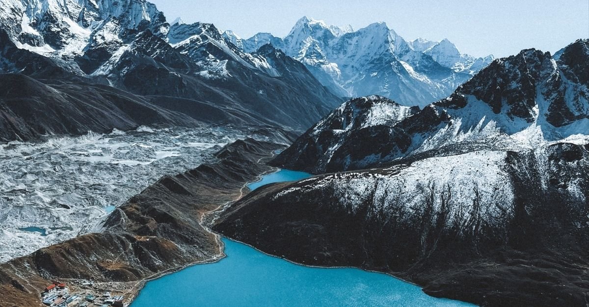
Nepal Himalayan flood risk
A mountain face that appeared stable for decades can become more vulnerable to rockfalls or landslides.
This creates a troubling chain:
warming → ice loss and thawing → weaker slopes → rock or ice collapse → river blockage or sudden displacement → flood
And the chain does not have to stop there.
A flood carrying large quantities of sediment and rock can destroy bridges, roads, hydropower facilities and settlements. It can also alter the course of a river.
This is why a high-mountain disaster can affect communities far beyond the location where the initial collapse occurred.
Why the narrow valleys make Nepal especially vulnerable
Nepal’s geography magnifies the problem.
Many settlements, roads, bridges, hydropower projects and trekking routes are concentrated along river valleys.
The mountains leave relatively little flat land.
That means people and infrastructure often have to live close to rivers.
Under normal conditions, this makes sense. Rivers provide water, transport routes and access through otherwise difficult terrain.
During an extreme flood, however, the same geography becomes dangerous.
A sudden surge moving through a narrow valley has limited space to spread sideways. It can therefore travel rapidly and carry enormous amounts of debris.
A bridge can become a blockage.
A damaged road can isolate an entire community.
A hydropower tunnel can become flooded.
And a settlement that appears far downstream from the original event may still be exposed.
The August 2026 disaster demonstrated this interconnected nature of mountain hazards, with damage extending through river systems and affecting major infrastructure.
Why are these floods so difficult to predict?
One of the biggest challenges is that the most dangerous events can happen quickly.
Meteorologists can track a storm.
Hydrologists can monitor river levels.
Satellites can observe changes in glaciers and lakes.
But predicting the exact moment when a piece of glacier or rock will collapse remains extremely difficult.
This creates what researchers sometimes call a detection gap.
A river monitoring station may detect the flood after it has already started.
A rainfall sensor may show nothing unusual.
A community several kilometres downstream may have only minutes to react.
This is why monitoring needs to move beyond rainfall.
Satellite imagery, seismic sensors, river gauges, drones, automatic cameras and other technologies can all contribute to a more complete warning network.
But technology alone is not enough.
A warning only saves lives if it reaches people quickly and there is a clear plan for what they should do next.
Nepal needs to prepare for more than one kind of flood
For decades, flood preparation has understandably focused heavily on monsoon rainfall.
That remains essential.
But the changing Himalayan environment means disaster planning needs to consider a wider range of scenarios.
A modern warning system needs to ask:
- What happens if a glacier collapses?
- What happens if a landslide enters a river?
- What happens if a glacial lake suddenly drains?
- What happens if extreme rainfall follows a mountain collapse?
- Which settlements are directly downstream?
- How quickly can a warning reach them?
- Which roads and bridges could be cut off?
- What happens if a hydropower facility is affected?
These questions are particularly important as Nepal continues to expand roads, hydropower and tourism infrastructure in mountain areas.
Development itself is not the problem.
The challenge is making sure that new infrastructure is designed around the hazards that are becoming better understood.
What can Nepal do to reduce the risk?
There is no single solution that can make Himalayan floods disappear.
But the risk can be reduced.
1. Monitor glaciers and glacial lakes more closely
Remote sensing can identify changes in glacier surfaces and lake size. High-risk locations can then receive closer monitoring.
2. Improve early-warning systems
Nepal needs warning networks capable of detecting not only rainfall and rising rivers, but also sudden changes associated with glacial and landslide events.
3. Map downstream risk
Knowing that a dangerous lake exists is only the beginning.
Authorities also need to know which villages, roads, bridges, hydropower projects and tourism sites could be affected if it fails.
4. Build evacuation plans before disasters happen
People should not have to decide where to go while a wall of water is already moving downstream.
Clear evacuation routes, shelters and communication systems can make an enormous difference.
5. Design infrastructure for a changing climate
Bridges, roads and hydropower projects need to account for the possibility of larger debris flows and sudden river changes.
6. Strengthen cooperation across borders
Many Himalayan rivers cross national boundaries.
A hazard originating in the high mountains of Tibet can affect communities downstream in Nepal and eventually India.
That makes cross-border data sharing and early warnings particularly important.
Does this mean Nepal’s mountains are becoming too dangerous to visit?
No.
It would be misleading to conclude that Nepal is becoming an unsafe destination simply because climate-related hazards are increasing.
Millions of people live, work and travel through the Himalayas every year.
The important change is that travelers, local communities and authorities need to understand the risks better.
Mountain travel has always involved hazards. Weather can change rapidly. Landslides can block trails. Altitude can affect the body. Rivers can rise quickly.
The changing climate adds another layer to that risk.
For travelers, this means checking current conditions before heading into remote mountain areas, following local warnings, using reputable trekking operators and avoiding routes that authorities have closed.
For Nepal, it means investing in the science and infrastructure needed to protect both residents and visitors.
The bigger question is not whether floods will happen
Nepal cannot stop every landslide.
It cannot prevent every glacier from melting.
It cannot control the world’s temperature on its own.
And it cannot eliminate the natural forces that have shaped the Himalayas for millions of years.
The more realistic question is whether Nepal can become better prepared for a mountain environment that is changing.
The August 2026 disaster is a painful reminder of what can happen when a high-altitude event suddenly connects with a populated river valley. It also demonstrates why Himalayan hazards cannot be viewed separately.
A glacier can influence a lake.
A lake can interact with a landslide.
A landslide can change a river.
A river can destroy infrastructure many kilometres away.
That chain is what makes the Himalayas so difficult—and increasingly important—to understand.
Nepal’s mountains are not simply melting.
They are changing.
And understanding that change may be one of the most important steps toward protecting the people, communities and landscapes that depend on them.
Frequently Asked Questions
Are floods in Nepal becoming more dangerous?
Some high-mountain hazards are becoming more concerning as the Himalayan climate changes. Glacier retreat, expanding glacial lakes, changing snow and rainfall patterns, and thawing frozen ground can alter the conditions that contribute to floods, landslides and avalanches. However, individual floods can have different causes, so scientists investigate each event separately.
What is a GLOF?
A Glacial Lake Outburst Flood, or GLOF, occurs when water stored in a glacial lake is suddenly released. The natural dam holding the lake can fail because of processes such as erosion, internal water movement, landslides or an avalanche entering the lake.
Is climate change causing floods in Nepal?
Climate change is increasing the environmental conditions that can contribute to some Himalayan hazards, but it is not accurate to say that climate change alone causes every flood. Rainfall, earthquakes, landslides, avalanches, glacier dynamics and local geography can all play important roles.
Why are Himalayan floods difficult to predict?
Some mountain floods can begin without heavy rainfall. A glacier collapse, landslide or sudden lake failure can release large amounts of water and debris with very little warning. Conventional rainfall and river-level monitoring therefore cannot detect every possible trigger.
Can Nepal prevent glacial floods?
It cannot prevent every natural event, but Nepal can reduce the damage through glacier and lake monitoring, early-warning systems, risk mapping, evacuation planning and climate-resilient infrastructure.
Are Nepal’s trekking destinations at greater risk?
Some mountain areas are more exposed than others. Risk depends on elevation, nearby glaciers and lakes, river valleys, terrain and infrastructure. Conditions can also change quickly, which is why travelers should check current local advisories before starting a trek.
Why does climate change matter so much in the Himalayas?
The Himalayas contain large amounts of snow and ice and are extremely sensitive to changes in temperature. Even relatively small changes can affect glaciers, snow, frozen ground, rivers and mountain slopes. Because millions of people depend on Himalayan water systems, changes in the mountains can have consequences far downstream.